long trip
10 Days Mountain Rwenzori climbing tour with summiting Margherita peak
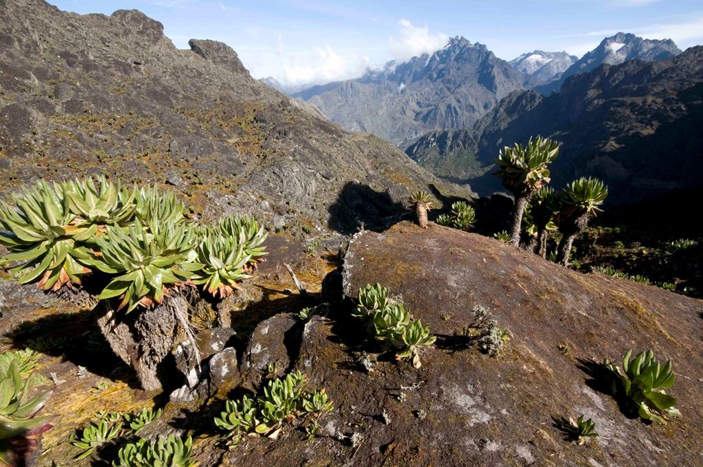
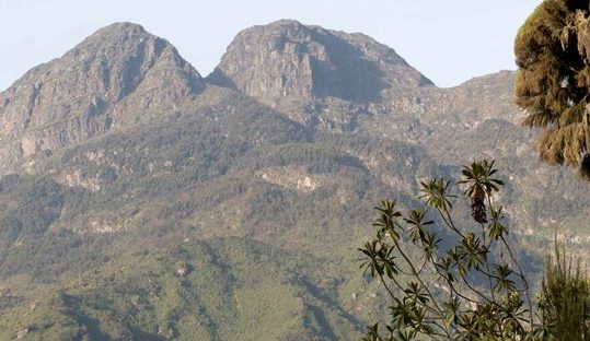
This 10 days Rwenzori Mountains hike and climbing tour takes you on one of the best mountain climbing adventures in the world, as of 2012 National Geographic ranked the Rwenzori Mountains the best in Africa and ninth in the whole world for hiking and climbing experiences. Climbers and hikers are treated to beautiful features, an array of wildlife and breathtaking scenery. Also, given the block type formation of the Rwenzori mountain, its terrain is highly uneven which makes climbing longer and challenging but that also means more adventurous!
The Rwenzori Mountains (Ruwenzori) are located in western Uganda, straddling the border with the Democratic Republic of Congo. They occupy 120km of length and 65km of width. They contain Africa’s third tallest mountain – Mt. Stanley 5109m, coming after Mt. Kilimanjaro (5,895m) of Tanzania, and Mt. Kenya (5,199m) of Kenya. The Rwenzoris are arguably the most beautiful mountains in Africa, supporting stunning glaciers, numerous rivers, waterfalls, lakes and a host of rare and endemic wildlife. They are also one of the only three mountains in Africa that have permanently snow-capped peaks.
Mountain Rwenzori in Uganda has two prominent hiking trails, that is, the Central Circuit trail and the Kilembe trail. On this tour you shall hike the Central Circuit and includes climbing to the highest peak of the Rwenzori Mountains which is the snow capped Margherita peak (5109m).


Tour Itinerary
You will be picked up from your hotel in Kampala or Entebbe at 7.00am and set off on the journey to western Uganda. After 4 – 5 hours you shall get to Fort Portal town which sits in the shadows of Mt Rwenzori and enjoys breathtaking views of volcanic landscape and the Rwenzoris in the backdrop. Have early lunch and thereafter hike to some of the nearby hills to view beautiful crater lakes and lush scenery. Later you drive to Mountain Rwenzori National Park in Kasese District, check into your accommodation where you spend the rest of the evening enjoying beautiful views of the mountains.
Accommodation: Equator Snow Lodge (midrange) or Ruboni Community Camp (Budget)
Meal plan: Lunch, Dinner
Nyakalengija (1648m) – Nyabitaba Hut (2651m)
Have early breakfast and then transfer to the park offices at Nyakalengija to meet the team that will cater to you during your time in the mountains. It includes porters, professional guides, a chef, and security personnel. Set off on the trek from Nyakalengija (1684m), passing through local communities and their fields, bamboo, high elephant grass and thick bushes. There is some climbing over rocks but do not offer much of a challenge. You will also cross over River Mahoma via a wooden bridge. There is plenty of wildlife to observe at this level. The legendary Three-horned Chameleon is one to look out for. Blue Monkey and the Black-and-white Colobus are some of the primates commonly sighted. For the bird lovers, Rwenzori has over 217 bird species including up to 17 species endemic to the Albertine Rift. Watch out for the colorful Rwenzori Turaco. After roughly 5 hours of ascending close to 1200m for a distance of 10km you will get to Nyabitaba Hut at 2651m. Settle in for the rest of the day, enjoy the surround beauty as your body adjusts to the elevation and prepares for u conquer the higher elevations.
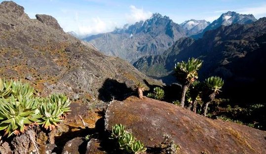
Leave Nyabitaba and follow the trail that first goes down through a forest to the Kurt Shafer Bridge, just below the confluence of Mubuku and Bujuku rivers. After this is a relatively easy trek through bamboo, after which it becomes strenuous when you go through a stretch of moss-covered rocks. From the Nyamuleju rock shelter, Mountains Stanely and Speke can be seen. From the rocks you cross into a zone of giant heather, lobelia and groundsel. You will walk through a large expanse of bog before getting to the John Matte Hut that marks the end of the day’s trek. From here you stand a chance of catching lovely views of Mt. Stanely and the Margherita glacia.
The trail continues from John Maate Hut down to cross the Bujuku River and enters Lower Bigo Bog, the home of giant lobelias. Jumping from tussock to tussock, the bog is finally crossed but rarely without the feet sampling some of the freezing ooze below. Continuing on to the upper bigo bog you will follow the Bujuku river that sometimes runs underground from lake Bujuku, with views of Mt. Baker to the South and Mt. Stanely to the West. Bujuku Hut, well located in the shadow of Mount Baker and Mount Speke, is set in a narrow valley below Stuhlmann Pass. Dinner and overnight at Bujuku hut.
From Bujuku continue the trail, going through more bog, climbing the steep slopes and through the Groundsel as it ascends to Scott-Elliot Pass at 4372m. At the end of the gully a metal ladder takes you over a steep section after which the trail is divided into two. The trail on your right leads up to Elena Hut and Mount Stanley on a steep trail over large boulders, while the trail on you left leads to Scott-Elliot Pass and down to Kitandara Lake. This left trail is taken by those who do not aim to Margherita peak to Ktandara Hut. Those climbing the peak will proceed to Elena Hut for dinner and overnight.
For those that want to reach Margherita peak (5109m), continue to the base of the Stanely Glacier. To reach the summit of Margherita, the climb takes about 5 – 7 hours depending on the weather conditions and pace of climbing the mountain. This tough walk takes you over three glaciers, slippery rock, ice, and very exposed areas which are open on many sides. Note that this climb is for only physically fit and technical climbers. Climbing on to the glaciers, cross the Stanley Plateau and proceed with the ascent. Acclimatized to fog, altitude sickness and coolly weather, scramble up to the summit of Margherita, the highest peak of Rwenzori Mountain. Given the high altitude and the tough conditions even if you do not make it to the peak, do not get disappointed. Prepare for your return through the Scott-Elliot Pass, where there are spectacular views back to Bujuku Lake and Mount Speke, up to Mount Stanley and down to Kitandara Lakes. After the trail that passes you an alpine zone of sparse vegetation and rough boulders, descend past the Kitandara Lakes for dinner and overnight at the Kitandara.
From Kitandara, follow the trail that ascends steeply up the headwall, spreading out from the base of Mount Baker and continuing along the south side of the mountain to Fresh Field Pass (4280m). At this point you can view into the Congo to the west and Mount Stanley to the north. From the pass, take on the long trail passing the rock shelter at Bujongolo, the base camp for the historic expedition by the Duke of Abruzzi in 1906. Overnight at Guy Yeoman.
The descend to Nyabitaba takes around 6 – 7 hours but with an early start it is possible to make it all the way to down to Nyakalengija . Below Guy Yeoman, the route descends the cliffs of Kichuchu. Beyond Kichuchu the muddy path crosses the Mubuku River twice before climbing upwards to Nyabitaba to complete the circuit.
Leave Nyabitaba hut early retracing out route back to the Nyakalengija. This is a 10km trail that usually takes 2 – 3 hours. Descending through Mubuku River and through fields to the park headquarters. Transfer your lodge for lunch and spend the rest of the day relaxing.
After breakfast, check out and travel to Kampala. Lunch en-route.
Trips includes/excludes
- Tour car and tour driver driver/guide
- Team of porters, chef, security, and guides
- Food items, stove, charcoal
- All accommodation including sleeping bag
- Climbing gear (harness, rope, ice axe, crampons)
- First aid kit
- Visa fees
- Personal insurance
- Airfares
- Tips
- All personal expenses such as laundry, phone bills, curio purchases
What you need to carry?
- Proper hiking boots
- Warm clothes
- A rain coat
- Snow glasses
- Insect repellent
- Sunscreen
Other Uganda trips with Mount Rwenzori hike
Related Trips
 21 Days Rwenzori Mountain Climbing and Uganda wildlife tour
 2 days Sipi fall hike and Jinja day tour
 3 days Mount Sabyinyo hiking tour
 5 Days Uganda trip with Jinja day tour, Sipi Falls hike and Murchison Falls Safari
 4 days Queen Elizabeth Park safari and Rwenzori waterfall hike
 5 days gorilla trekking and volcano hiking trip in Uganda
 3 days Chimpanzee trip Kibale National Park
 5 days safari trip to Kidepo Valley National Park


